Knowledge Graph Scripture & Encyclopedia

Search & Explore

Multimedia Filter:
Suggested topics:
Found 36 topics & entities and 24 verses in 1904ms • Auto-routed to Keyword-First
Topic Overview

Nehemiah Map

Nehemiah Map (Interactive Book Map • Nehemiah ): Geographic map plotting ancient cities, rivers, mountains, and events recorded across the Book of Nehemiah. Within the broader Biblical Knowledge Graph, this connects directly to Babylonian Captivity & Post-Exilic Return—In 586 BCE, Nebuchadnezzar of Babylon destroyed Jerusalem and deported Judah , including King Jehoiachin and High Priest Jehozadak ( 1 Chronicles 6:15 ), before the Persian decree of Cyrus enabled Zerubbabel , Joshua , Ezra , and Nehemiah to rebuild the Temple and walls of Jerusalem .

Biblical Geography & Sacred Architecture

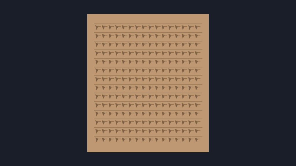
3D Sanctuary Reconstructions: Ur III Sumerian Cuneiform Tablet — Mesopotamian clay administrative tablet from the Third Dynasty of Ur (c. 2100–2000 BC) recording offerings of barley-fed sheep and goats, illustrating the scribal culture and urban economy of southern Mesopotamia around the patriarchal era of Ur of the Chaldeans ( Genesis 11:28–31 ).

Scripture Witness (KJV) & Canonical Context

Primary KJV scripture witnesses include Nehemiah 10:2 : " Seraiah , Azariah , Jeremiah ,"; Nehemiah 10:3 : "Pashur, Amariah , Malchijah ,"; Nehemiah 10:4 : "Hattush, Shebaniah, Malluch,". Related canonical books and chapters: Nehemiah (Old Testament • 13 Chapters).

Connected Topics & Entities Book/Chapter Verse Person Place Lexicon Theology Commentary History Perspective

Topics, People & Places (36)

Nehemiah Map
99% Book Map
Interactive Book Map • Nehemiah

Geographic map plotting ancient cities, rivers, mountains, and events recorded across the Book of Nehemiah .

Nehemiah
99% Old Testament
Old Testament • 13 Chapters

Nehemiah (Old Testament, 13 chapters). Key figures: Judah , Jacob/Israel , Moses , Asaph , Berechiah , Zadok . Key places: Jerusalem , Jericho , Gibeon , Mizpah 3 , Zanoah 1 , Keilah . Opens with: "The words of Nehemiah the son of Hachaliah. And it came to pass in the month Chisleu, in the twentieth year, as I was in Shushan the palace,..."

Elephantine Passover Letter (Papyrus 13464)
IMAGE • manuscripts

Aramaic papyrus letter sent by Hananiah to the Jewish military colony on Elephantine island concerning Passover observances.

Curators & Archaeologists of Neues Museum, Berlin • Neues Museum, Berlin / Wikimedia Commons Public Domain Mark 1.0
Samaria Papyri from Wadi Daliyeh
IMAGE • manuscripts

Persian-period Aramaic legal documents discovered in the Mugharet Abu Shinjeh cave sealing slave sales and property transfers.

Curators & Archaeologists of Israel Museum • Israel Museum / Wikimedia Commons Public Domain Mark 1.0
Map of Nehemiah's Rebuilt Jerusalem Walls & Gates
IMAGE • maps

Archaeological reconstruction of the gates (Sheep, Fish, Valley, Dung, Fountain) and sectors rebuilt by the returnees.

Historical Biblical Cartographers • Geographicus / Wikimedia Commons Public Domain Mark 1.0
Persepolis Apadana Staircase Procession
IMAGE • artwork

Carved stone staircase frieze showing 23 foreign nations bearing gifts and horses to the Persian Great King at the New Year festival.

Curators & Archaeologists of Persepolis, Iran • Persepolis, Iran / Wikimedia Commons Public Domain Mark 1.0
Pool of Siloam Stepped Bath Excavations
IMAGE • geography

Monumental stone stepped pool at the southern extremity of the City of David where Jesus sent the man born blind to wash.

Israel PikiWiki project • Israel PikiWiki CC-BY 2.5
Map of the Persian Empire & Jewish Return under Cyrus
IMAGE • maps

The twenty satrapies of the Achaemenid Empire and the return routes of Zerubbabel , Ezra , and Nehemiah .

Historical Biblical Cartographers • Geographicus / Wikimedia Commons Public Domain Mark 1.0
Wiki Article • History & Monarchy

In 586 BCE, Nebuchadnezzar of Babylon destroyed Jerusalem and deported Judah , including King Jehoiachin and High Priest Jehozadak ( 1 Chronicles 6:15 ), before the Persian decree of Cyrus enabled Zerubbabel , Joshua , Ezra , and Nehemiah to rebuild the Temple and walls of Jerusalem .

Elephantine Papyri & Temple Petition
99% direct_archaeological
5th-century BC Aramaic legal documents and petition from a Jewish military colony in Upper Egypt

Hundreds of Aramaic legal, marriage, and communal papyri from a garrison of Jewish soldiers protecting the southern frontier of the Persian Empire, featuring a temple dedicated to YHW.

Nehemiah Chapter 13, Verse 28

Scripture passage in Nehemiah 13:28

Books of Ezra-Nehemiah 8:37
VIDEO • overview

Overview of Ezra - Nehemiah detailing the return from Babylonian exile, rebuilding the temple under Zerubbabel and Jerusalem walls under Nehemiah , revealing the need for transformed hearts.

BibleProject • BibleProject CC BY-NC-ND 4.0 / Standard YouTube License
Nehemiah 13:1
99% Verse
Nehemiah Chapter 13, Verse 1

Scripture passage in Nehemiah 13:1

c. 550–330 BC massive Iranian world empire of Cyrus, Darius, Xerxes, and Artaxerxes spanning from Egypt to India

The greatest empire the ancient world had yet seen, founded by Cyrus the Great, governed through regional governors (satraps), the Royal Road postal courier system, standardized silver darics, and imperial religious tolerance, providing the setting for Ezra , Nehemiah , and Esther .

Nehemiah 4:1
99% Verse
Nehemiah Chapter 4, Verse 1

Scripture passage in Nehemiah 4:1

c. 490–404 BC Marathon, Thermopylae, Parthenon construction, and Socrates parallel with Ezra-Nehemiah

The apex of classical Greek culture, initiated by the Greco-Persian Wars (Darius I defeated at Marathon, Xerxes checked at Thermopylae and crushed at Salamis ), blossoming into the Athenian democracy of Pericles, construction of the Parthenon, tragic drama, and the philosophy of Socrates.

Neo-Babylonian Empire at Peak (605–562 BC)
IMAGE • maps

Cartographic map detailing the territorial extent of Nebuchadnezzar's empire and deportation routes from Judah to Babylon .

Curators & Archaeologists of Department of Ancient Near Eastern Art • Department of Ancient Near Eastern Art / Wikimedia Commons Public Domain Mark 1.0
Neo-Assyrian Empire Expansion Map
IMAGE • maps

Imperial territorial expansion map showing conquests from Tiglath-Pileser III to Ashurbanipal and the fall of Samaria (722 BC).

Curators & Archaeologists of Oriental Institute, Chicago • Oriental Institute, Chicago / Wikimedia Commons Public Domain Mark 1.0
Ancient Near Eastern Trade Routes
IMAGE • maps

Cartographic map tracing the Way of the Sea (Via Maris), King's Highway , and Incense Route linking Egypt , Canaan , and Mesopotamia .

Curators & Archaeologists of Survey of Western Palestine • Survey of Western Palestine / Wikimedia Commons Public Domain Mark 1.0
Roman Judea and Decapolis under Herodian Tetrarchy
IMAGE • maps

Detailed administrative map of Roman Judea , Samaria , Galilee , Perea, Iturea, and the Decapolis during the ministry of Jesus .

Curators & Archaeologists of Bible Graph Cartography • Bible Graph Cartography / Wikimedia Commons Public Domain Mark 1.0
Achaemenid Persian Empire and Royal Road
IMAGE • maps

Map charting the 20 satrapies of the Persian Empire stretching from the Indus to the Nile and the 2,500 km Susa – Sardis Royal Road.

Curators & Archaeologists of Ancient World Mapping Center • Ancient World Mapping Center / Wikimedia Commons Public Domain Mark 1.0
Divided Kingdom of Israel and Judah
IMAGE • maps

Geographical boundaries of the Northern Kingdom of Israel , Southern Kingdom of Judah , and border kingdoms of Aram , Ammon , and Moab .

Curators & Archaeologists of Bible Graph Cartography • Bible Graph Cartography / Wikimedia Commons Public Domain Mark 1.0
Partition of Alexander's Empire (Diadochi)
IMAGE • maps

Map displaying the Hellenistic successor kingdoms: Ptolemaic Egypt , Seleucid Syria , Antigonid Macedonia , and Lysimachus' Thrace.

Curators & Archaeologists of Classical Atlas Project • Classical Atlas Project / Wikimedia Commons Public Domain Mark 1.0
Roman Empire Provinces under Augustus and Tiberius
IMAGE • maps

Comprehensive provincial map of the Roman world showing senatorial and imperial provinces surrounding the Mediterranean.

Curators & Archaeologists of Ancient World Mapping Center • Ancient World Mapping Center / Wikimedia Commons Public Domain Mark 1.0
Nehemiah 2:1
99% Verse
Nehemiah Chapter 2, Verse 1

Scripture passage in Nehemiah 2:1

Canaanite City-States in the Late Bronze Age
IMAGE • maps

Map showing fortified city-states of Canaan ( Hazor , Megiddo , Gezer , Lachish , Jerusalem , Shechem ) during the Amarna Period.

Curators & Archaeologists of Israel Antiquities Authority • Israel Antiquities Authority / Wikimedia Commons Public Domain Mark 1.0
2 Samuel Map
99% Book Map
Interactive Book Map • 2 Samuel

Geographic map plotting ancient cities, rivers, mountains, and events recorded across the Book of 2 Samuel .

Eurasian Silk Road (Rome to Han Dynasty)
IMAGE • maps

Continental trans-Eurasian trade route network connecting the Roman Empire, Parthian Persia , Kushan Empire, and Han Dynasty China.

Curators & Archaeologists of UNESCO Silk Road Programme • UNESCO Silk Road Programme / Wikimedia Commons Public Domain Mark 1.0
Ur III Sumerian Cuneiform Tablet 3D & AR
Interactive 3D Cuneiform Tablet • Genesis 11:28–31

Mesopotamian clay administrative tablet from the Third Dynasty of Ur (c. 2100–2000 BC) recording offerings of barley-fed sheep and goats, illustrating the scribal culture and urban economy of southern Mesopotamia around the patriarchal era of Ur of the Chaldeans ( Genesis 11:28–31 ).

2 Peter Map
99% Book Map
Interactive Book Map • 2 Peter

Geographic map plotting ancient cities, rivers, mountains, and events recorded across the Book of 2 Peter .

2 Timothy Map
99% Book Map
Interactive Book Map • 2 Timothy

Geographic map plotting ancient cities, rivers, mountains, and events recorded across the Book of 2 Timothy .

Nehemiah 2:19
99% Verse
Nehemiah Chapter 2, Verse 19

Scripture passage in Nehemiah 2:19

Jeremiah Map
99% Book Map
Interactive Book Map • Jeremiah

Geographic map plotting ancient cities, rivers, mountains, and events recorded across the Book of Jeremiah .

1 Samuel Map
99% Book Map
Interactive Book Map • 1 Samuel

Geographic map plotting ancient cities, rivers, mountains, and events recorded across the Book of 1 Samuel .

2 Kings Map
99% Book Map
Interactive Book Map • 2 Kings

Geographic map plotting ancient cities, rivers, mountains, and events recorded across the Book of 2 Kings .

Map of the 40-Year Wilderness Wanderings & Mount Sinai
IMAGE • maps

Station route from Mount Sinai / Horeb through Kadesh-barnea , Edom , and Moab to the Jordan crossing.

Historical Biblical Cartographers • Geographicus / Wikimedia Commons Public Domain Mark 1.0

Scripture Passages (24)

Hattush, Shebaniah, Malluch,

Harim, Meremoth, Obadiah ,

Meshullam, Abijah , Mijamin,

Micha, Rehob , Hashabiah,

Zaccur, Sherebiah, Shebaniah,

Hodijah, Bani, Beninu.

Bunni, Azgad, Bebai,

Adonijah, Bigvai, Adin,

Hodijah, Hashum, Bezai,

Magpiash, Meshullam, Hezir,

Meshezabeel, Zadok , Jaddua,

Pelatiah, Hanan , Anaiah,

Hoshea, Hananiah, Hashub,

Hallohesh, Pileha, Shobek,

Rehum, Hashabnah, Maaseiah,

Malluch, Harim, Baanah.

Amariah , Malluch, Hattush,

Link copied to clipboard
Article Wiki

Title

Open Page → Explore